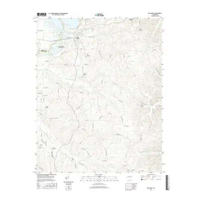
2016 Map of Big Sandy
USGS Topo · Published 2016About this map
Big Sandy serves as the primary hub in this West Tennessee landscape, situated where the Big Sandy River meets the expansive waters of Kentucky Lake. The map details a transition from the river's dewatering areas and drainage ditches to the complex creek systems that define the rural interior. Numerous family and community burial sites, such as Lindsey Cem, Sugar Creek Cem, and Rushings Creek Cem, are scattered across the terrain, offering significant data for genealogical research. The presence of features like Benton Cut and the Ramble Cr Drainage Ditch suggests a history of landscape modification to manage the water levels of the surrounding river network. These watercourses, including Rushing Cr and Ramble Cr, dictated the placement of local roads like Bakers Chapel-Church Rd and Rushing Creek Church Rd, reflecting how the area’s early spiritual and social centers were tied to the winding topography of the river valley.
Find a feature on this map
84 named features on this map. Tap any name to fly to it.
Don’t see what you’re looking for? This feature index may not catch every label — zoom into the map to look around manually.
Map Details
Editions of this 2016 Big Sandy Map
This is the sole edition of this map. No revisions or reprints were ever made.
Other maps of this area

1936 · Poplar Creek
USGS Topo · 1:24,000

1936 · McKinnon
USGS Topo · 1:24,000

1936 · Camden
USGS Topo · 1:24,000

1936 · Big Sandy
USGS Topo · 1:24,000

1936 · Johnsonville
USGS Topo · 1:24,000

1936 · Bruceton
USGS Topo · 1:24,000

1936 · Harmon Creek
USGS Topo · 1:24,000

1936 · Manleyville
USGS Topo · 1:24,000

1936 · Springville
USGS Topo · 1:24,000

1938 · Springville
USGS Topo · 1:24,000