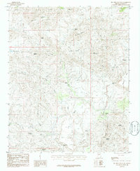
1986 Map of Big Shipp Mountain
USGS Topo · Published 1986About this map
Big Shipp Mountain and Little Shipp Mountain dominate this mid-1980s landscape in Yavapai County, where the topography is defined by high mesas and intricate drainage basins. The Santa Maria River cuts through the southeastern corner, serving as a primary hydrological feature fed by numerous seasonal washes such as Little Shipp Wash, Sycamore Wash, and Cottonwood Creek. This map reveals a reliance on isolated water sources typical of the high desert, documenting several named springs and tanks that served as vital landmarks for local navigation and cattle ranching. Features like Rockhouse Spring, Dead Cow Spring, and Brushy Basin Tank reflect the practical nomenclature of the era. The presence of Chimney Rock and Burro Mountain provides distinctive navigational points within the complex terrain, while the extensive labeling of landforms like The Rincon offers a clear view of the area's geological character before modern development.
Find a feature on this map
25 named features on this map. Tap any name to fly to it.
Don’t see what you’re looking for? This feature index may not catch every label — zoom into the map to look around manually.
Map Details
Editions of this 1986 Big Shipp Mountain Map
This is the sole edition of this map. No revisions or reprints were ever made.
Other maps of this area

1887 · Prescott
USGS Topo · 1:250,000

1892 · Prescott
USGS Topo · 1:250,000

1903 · Congress
USGS Topo · 1:125,000

1904 · Congress
USGS Topo · 1:125,000

1923 · Signal
USGS Topo · 1:250,000

1942 · Signal
USGS Topo · 1:250,000

1945 · Bagdad
USGS Topo · 1:62,500

1947 · Sheridan Mountain
USGS Topo · 1:62,500

1948 · Sheridan Mountain
USGS Topo · 1:63,360

1948 · Bagdad
USGS Topo · 1:62,500