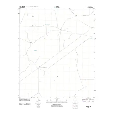
2010 Map of Big Sinks
USGS Topo · Published 2010About this map
Twin Wells Ranch serves as a central point of habitation in this arid landscape of southeast New Mexico, where the availability of water dictates the pattern of human activity. The terrain is defined by natural depressions and drainage features, most notably the Big Sinks and the seasonal path of Dog Draw. Livestock and ranching operations are supported by a critical network of man-made water sources, including Poker Tank and Greenwood Tank, alongside several working windmills such as Eagles Windmill and Keyhole Windmill. A series of rural thoroughfares, including County Rd 787 and McDonald Rd, provide access through the scrubland, connecting the isolated ranch house to the wider region. High points like Centinela Mound offer visual landmarks in an area otherwise characterized by low-lying basins like Poker Lake.
Find a feature on this map
17 named features on this map. Tap any name to fly to it.
Don’t see what you’re looking for? This feature index may not catch every label — zoom into the map to look around manually.
Map Details
Editions of this 2010 Big Sinks Map
This is the sole edition of this map. No revisions or reprints were ever made.
Other maps of this area

1939 · Nash Draw
USGS Topo · 1:62,500

1943 · Nash Draw
USGS Topo · 1:62,500

1954 · Hobbs
USGS Topo · 1:250,000

1958 · Hobbs
USGS Topo · 1:250,000

1963 · Hat Mesa
USGS Topo · 1:62,500
1968 · Pierce Canyon
USGS Topo · 1:24,000

1968 · Phantom Banks
USGS Topo · 1:24,000
1968 · Big Sinks
USGS Topo · 1:24,000
1968 · Ross Ranch
USGS Topo · 1:24,000

1973 · Paduca Breaks NW
USGS Topo · 1:24,000