
1968 Map of Phantom Banks
USGS Topo · Published 1971About this map
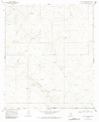
Phantom Banks and the surrounding high desert of Eddy County reveal a landscape defined by the search for water and resources in the late 1960s. The terrain is deeply incised by Brushy Draw and Tucker Draw, leading toward the complex topography of the banks. Human activity in this arid environment is marked by numerous water catchments like Big Seep Tank, Cockleberry Tank, and Park Tank, which supported the livestock operations at Steeple Ranch. Beyond ranching, the map documents the industrial footprint of the era, including an Oil Well and a concentration of a Drill Hole sites, alongside specialized landmarks such as Target Windmill and Gyp Windmill. A network of simple trails, including a Jeep Trail, provides the primary access through this remote section of southeastern New Mexico.
Find a feature on this map
17 named features on this map. Tap any name to fly to it.
Don’t see what you’re looking for? This feature index may not catch every label — zoom into the map to look around manually.
Map Details
Editions of this 1968 Phantom Banks Map
2 editions found
Other maps of this area

1925 · Orla 2-b
USGS Topo · 1:48,000

1931 · Orla
USGS Topo · 1:62,500

1954 · Hobbs
USGS Topo · 1:250,000

1954 · Pecos
USGS Topo · 1:250,000

1957 · Pecos
USGS Topo · 1:250,000

1958 · Hobbs
USGS Topo · 1:250,000
1968 · Pierce Canyon
USGS Topo · 1:24,000

1968 · Orla NE
USGS Topo · 1:24,000
1968 · Red Bluff
USGS Topo · 1:24,000
1968 · Big Sinks
USGS Topo · 1:24,000