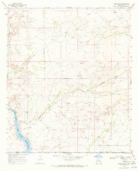
1968 Map of Ross Ranch
USGS Topo · Published 1971About this map
Pecos River Red Bluff Reservoir defines the southwestern corner of this 1960s landscape, where the water meets the arid terrain of the Rustler Breaks. The land is marked by the seasonal drainage patterns of Brushy Draw and Tucker Draw, which cut through a region dominated by ranching and industrial utility. Ross Ranch stands as a primary local landmark in a territory crisscrossed by an extensive Pipeline network and dotted with numerous drill holes, reflecting the area's mid-century reliance on resource extraction. The presence of several Gravel Pits and the small settlement of Rustler further illustrate the working character of this Eddy County landscape during a period of steady petroleum and mineral exploration.
Find a feature on this map
11 named features on this map. Tap any name to fly to it.
Don’t see what you’re looking for? This feature index may not catch every label — zoom into the map to look around manually.
Map Details
Editions of this 1968 Ross Ranch Map
This is the sole edition of this map. No revisions or reprints were ever made.
Other maps of this area

1925 · Orla 2-b
USGS Topo · 1:48,000

1931 · Orla
USGS Topo · 1:62,500

1945 · Malaga
USGS Topo · 1:62,500

1946 · Malaga
USGS Topo · 1:62,500

1954 · Carlsbad
USGS Topo · 1:250,000

1954 · Hobbs
USGS Topo · 1:250,000

1954 · Van Horn
USGS Topo · 1:250,000

1954 · Pecos
USGS Topo · 1:250,000

1957 · Pecos
USGS Topo · 1:250,000

1958 · Van Horn
USGS Topo · 1:250,000