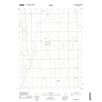
2019 Map of Big Springs Ranch
USGS Topo · Published 2019About this map
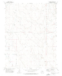
USAF Academy Bullseye Auxiliary Airfield stands as a focal point in this southern section of the High Plains, where military aviation infrastructure meets the sprawling agricultural landscape of El Paso County. The area is defined by a network of wide-reaching drainages, most notably Black Squirrel Cr and Big Springs Cr, which influence the local topography. At the northern edge, the namesake Big Springs Ranch marks a traditional land use that contrasts with the more modern residential development hinted at by street names like Sangre de Cristo View Rd and Mountain Range View Rd. The transition from rural homesteads to contemporary subdivisions is visible through the dense grid of residential roads, such as Dinner Bell Dr and Buffalo Grass Pt, while major thoroughfares like Calhan Hwy and Sanborn Rd maintain the area's connectivity to the broader region.
Find a feature on this map
37 named features on this map. Tap any name to fly to it.
Don’t see what you’re looking for? This feature index may not catch every label — zoom into the map to look around manually.
Map Details
Editions of this 2019 Big Springs Ranch Map
This is the sole edition of this map. No revisions or reprints were ever made.
Other maps of this area

1893 · Big Springs
USGS Topo · 1:125,000
1954 · Ellicott
USGS Topo · 1:24,000
1954 · Haegler Ranch
USGS Topo · 1:24,000
1954 · Hanover NW
USGS Topo · 1:24,000

1954 · Pueblo
USGS Topo · 1:250,000

1957 · Pueblo
USGS Topo · 1:250,000

1958 · Pueblo
USGS Topo · 1:250,000

1962 · Pueblo
USGS Topo · 1:250,000

1966 · Pueblo
USGS Topo · 1:250,000
1973 · Hanover NE
USGS Topo · 1:24,000