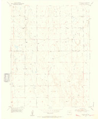
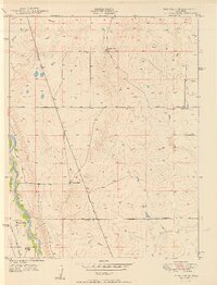
1954 Map of Hanover NW
USGS Topo · Published 1955About this map
Windmills dot the landscape of the El Paso County plains in this mid-1950s survey, emphasizing a rural economy dependent on well-drawn water. The terrain is defined by the drainage systems of Chico Creek and Black Squirrel Creek, where seasonal water patterns shaped the early road network. Local transport follows the lowlands via the Squirrel Creek Road and Black Squirrel Creek Road, while numerous Jeep Trails provide access across the open range. A distinctive topographic landmark, Crows Roost, rises above the surrounding flats in the northeastern corner of the quadrangle. This era of mapping captures the transition of the Colorado high plains before significant modern development, preserving the exact locations of the primary livestock watering points and the traditional ranch routes that connected this part of the state to the Ellicott and Hanover vicinities.
Find a feature on this map
10 named features on this map. Tap any name to fly to it.
Don’t see what you’re looking for? This feature index may not catch every label — zoom into the map to look around manually.
Map Details
Editions of this 1954 Hanover NW Map
Other maps of this area

1893 · Big Springs
USGS Topo · 1:125,000

1893 · Colorado Springs
USGS Topo · 1:125,000

1909 · Colorado Springs
USGS Topo · 1:125,000

1942 · Colorado Springs
USGS Topo · 1:125,000

1948 · Fountain SE
USGS Topo · 1:24,000

1948 · Falcon
USGS Topo · 1:62,500

1949 · Corral Bluffs
USGS Topo · 1:24,000
1950 · Fountain NE
USGS Topo · 1:24,000
1950 · Fountain SE
USGS Topo · 1:24,000
1951 · Falcon
USGS Topo · 1:62,500