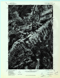
1977 Map of Big Squaw Pond
USGS Topo · Published 1981About this map
Moosehead Lake defines the northeastern edge of this remote Maine landscape, where the waters of the West Branch Piscataquis River flow through the southern timberlands. The orthophoto imagery, derived from high-altitude aerial photography taken in late 1977, reveals the stark contrast between the dense forest cover and the high ridges of Big Squaw Mountain and Little Squaw Mountain. Smaller bodies of water including Big Squaw Pond and Big Indian Pond are scattered throughout the quadrangle, connected by a network of drainage ways like Squaw Brook and Little Squaw Brook. This map provides a unique visual record of the region's topography before significant modern development, documenting the exact state of the forest and waterways during the late 1970s.
Find a feature on this map
9 named features on this map. Tap any name to fly to it.
Don’t see what you’re looking for? This feature index may not catch every label — zoom into the map to look around manually.
Map Details
Editions of this 1977 Big Squaw Pond Map
This is the sole edition of this map. No revisions or reprints were ever made.
Other maps of this area

1905 · The Forks
USGS Topo · 1:62,500

1907 · The Forks
USGS Topo · 1:62,500

1920 · Moosehead Lake
USGS Topo · 1:62,500

1921 · Brassua Lake
USGS Topo · 1:62,500

1922 · Moosehead Lake
USGS Topo · 1:62,500

1923 · Brassua Lake
USGS Topo · 1:62,500

1930 · Moosehead Lake
USGS Topo · 1:62,500

1944 · Brassua Lake
USGS Topo · 1:62,500

1944 · Moosehead Lake
USGS Topo · 1:62,500

1951 · Greenville
USGS Topo · 1:62,500
Featured Places
- Shirley, ME
- Big Moose Township, ME
- Squaretown Township, ME
- Harfords Point Township, ME
- East Moxie Township, ME