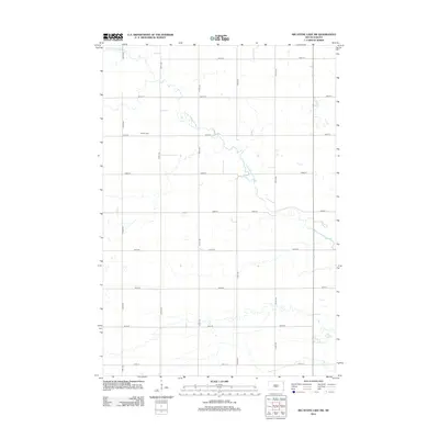
2012 Map of Big Stone Lake SW
USGS Topo · Published 2012About this map
The winding N Fork Whetstone River carves a sinuous path through this agricultural section of Grant County, South Dakota. This 2012 survey documents a strictly organized landscape, where the Jeffersonian grid of section-line roads, such as 139th St and 473rd Ave, creates a predictable framework for the rural homesteads and fields. Located north of the 141st Street line, the Corona Cem serves as a primary genealogical landmark for local families. The map illustrates the varied hydrology of the region, featuring several small wetlands and prairie potholes scattered between the river's bends and the straight corridors of gravel roads like 147th St.
Find a feature on this map
16 named features on this map. Tap any name to fly to it.
Don’t see what you’re looking for? This feature index may not catch every label — zoom into the map to look around manually.
Map Details
Editions of this 2012 Big Stone Lake SW Map
This is the sole edition of this map. No revisions or reprints were ever made.
Other maps of this area

1953 · Milbank
USGS Topo · 1:250,000

1954 · Big Stone Lake
USGS Topo · 1:62,500

1958 · Milbank
USGS Topo · 1:250,000

1971 · Big Stone Lake East
USGS Topo · 1:24,000

1971 · Corona
USGS Topo · 1:24,000

1971 · Big Stone Lake West
USGS Topo · 1:24,000

1971 · Big Stone Lake SE
USGS Topo · 1:24,000

1971 · Big Stone Lake SW
USGS Topo · 1:24,000
1971 · Wilmot
USGS Topo · 1:24,000

1973 · Twin Brooks
USGS Topo · 1:24,000