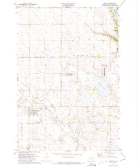
1971 Map of Wilmot
USGS Topo · Published 1974About this map
Wilmot serves as the primary hub of this eastern South Dakota landscape, situated at the junction of the Chicago Milwaukee St Paul and Pacific railroad and local transport routes. The terrain is defined by the prairie pothole region's characteristic wetlands and water bodies, most notably Big Stone Lake in the northeast corner and Bullhead Lake centrally. The agricultural character of the early 1970s is evident in the dense network of field lines and section boundaries that divide the townships of Lake, Garfield, and Springdale. For genealogists and local historians, the map identifies specific landmarks like the Wilmot Cemetery, Township Cemetery, and the local Townhall. Conservation efforts are also prominent, with the National Waterfowl Production Area preserved among the scattered lakes and the Whetstone River winding through the southern reaches.
Find a feature on this map
19 named features on this map. Tap any name to fly to it.
Don’t see what you’re looking for? This feature index may not catch every label — zoom into the map to look around manually.
Map Details
Editions of this 1971 Wilmot Map
This is the sole edition of this map. No revisions or reprints were ever made.
Other maps of this area

1916 · Peever
USGS Topo · 1:62,500

1916 · Beardsley
USGS Topo · 1:62,500

1918 · Peever
USGS Topo · 1:62,500

1918 · Beardsley
USGS Topo · 1:62,500

1953 · Milbank
USGS Topo · 1:250,000

1954 · Big Stone Lake
USGS Topo · 1:62,500

1958 · Milbank
USGS Topo · 1:250,000

1970 · Marvin
USGS Topo · 1:24,000

1970 · Wilmot NW
USGS Topo · 1:24,000

1971 · Corona
USGS Topo · 1:24,000