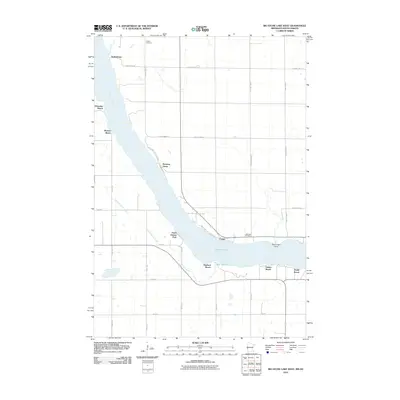
2010 Map of Big Stone Lake West
USGS Topo · Published 2010About this map
Big Stone Lake dominates this 2010 landscape, carving a wide path along the border where several recreational and residential hubs cluster. The shoreline is punctuated by local gathering spots and landings such as Hiawatha Beach, Madsen Beach, and Linden Beach, reflecting the area's long-standing draw for vacationers and lakeside residents. To the north, Yankeetown sits near Fish Creek and the headwaters of the Minnesota River, while the southern reaches feature Big Stone Lake State Park and South Dakota Park bordering the water. Local heritage is grounded at Holden Cemetery and Lakeside Cemetery, which provide points of interest for genealogists tracking families from the Foster area. The map illustrates a developed network of county highways and local roads like Trails End Rd, showing how the rural agricultural grid meets the winding topography of Hartford Beach Creek.
Find a feature on this map
36 named features on this map. Tap any name to fly to it.
Don’t see what you’re looking for? This feature index may not catch every label — zoom into the map to look around manually.
Map Details
Editions of this 2010 Big Stone Lake West Map
This is the sole edition of this map. No revisions or reprints were ever made.
Other maps of this area

1916 · Peever
USGS Topo · 1:62,500

1916 · Beardsley
USGS Topo · 1:62,500

1918 · Peever
USGS Topo · 1:62,500

1918 · Beardsley
USGS Topo · 1:62,500

1953 · Milbank
USGS Topo · 1:250,000

1954 · Big Stone Lake
USGS Topo · 1:62,500

1958 · Milbank
USGS Topo · 1:250,000

1971 · Big Stone Lake East
USGS Topo · 1:24,000

1971 · Corona
USGS Topo · 1:24,000

1971 · Browns Valley
USGS Topo · 1:24,000