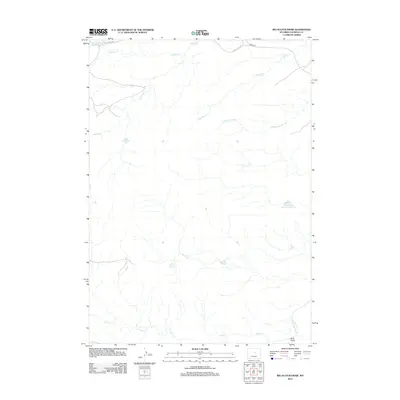
2012 Map of Big Sulfur Draw
USGS Topo · Published 2012About this map
Big Sulfur Spring and a network of seasonal watercourses define this high-plains landscape in Natrona County during the early 21st century. The terrain is deeply etched by ephemeral drainages and draws that feed the S Fork Powder River, illustrating the vital role of water management in this arid environment. Strategic water storage is evident through features such as the Alkali Reservoir, Lower Hackett Creek Reservoir, and the uniquely named Suicide Bed Grounds Reservoir. Settlement is sparse, with infrastructure largely limited to the transit corridor of 33 Mile Rd in the north and various unimproved trails. The map serves as a detailed record of the hydrography of the region, from the headwaters of Indian Cr to the confluence points of Lone Bear Cr and its southern fork, providing a clear picture of the land's drainage patterns and resource distribution.
Find a feature on this map
12 named features on this map. Tap any name to fly to it.
Don’t see what you’re looking for? This feature index may not catch every label — zoom into the map to look around manually.
Map Details
Editions of this 2012 Big Sulfur Draw Map
This is the sole edition of this map. No revisions or reprints were ever made.
Other maps of this area

1955 · Arminto
USGS Topo · 1:250,000

1958 · Arminto
USGS Topo · 1:250,000

1962 · Arminto
USGS Topo · 1:250,000

1968 · Willow Creek School
USGS Topo · 1:24,000

1968 · Roughlock Hill
USGS Topo · 1:24,000

1968 · Reynolds Reservoir
USGS Topo · 1:24,000

1968 · Big Sulfur Draw
USGS Topo · 1:24,000

1968 · Fiftymile Flat
USGS Topo · 1:24,000
1968 · Anderson Draw
USGS Topo · 1:24,000

1968 · Flat Top Hill
USGS Topo · 1:24,000