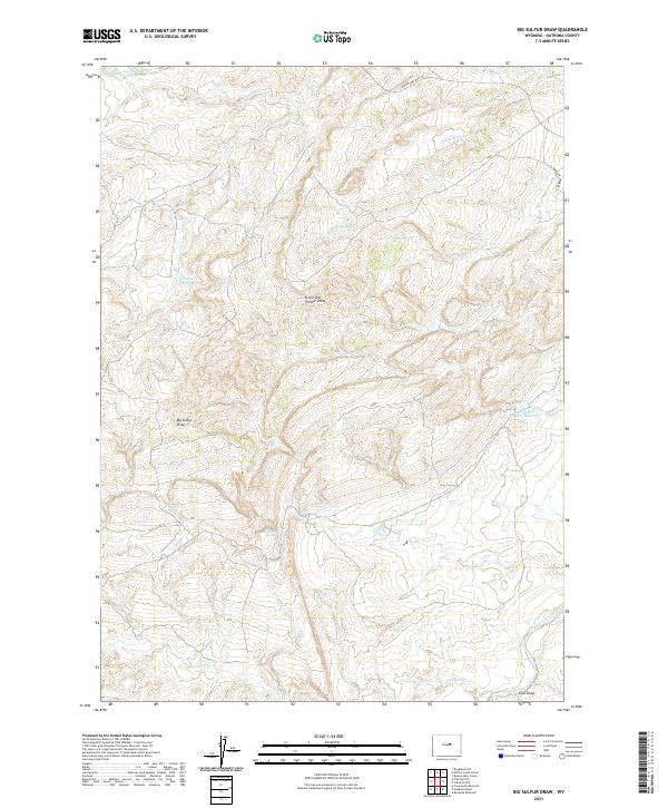
2021 Map of Big Sulfur Draw
USGS Topo · Published 2021About this map
Big Sulfur Spring and the surrounding drainage systems of Natrona County characterize this high-plains landscape. The area is defined by its complex network of seasonal water sources and draws, including the namesake Big Sulfur Draw and the distinctive Stone and Timber Draw. Water management for livestock and local use is evident through scattered reservoirs such as Alkali Reservoir, Lower Hackett Cr Reservoir, and the curiously named Suicide Bed Grounds Reservoir.
Find a feature on this map
18 named features on this map. Tap any name to fly to it.
Don’t see what you’re looking for? This feature index may not catch every label — zoom into the map to look around manually.
Map Details
Editions of this 2021 Big Sulfur Draw Map
This is the sole edition of this map. No revisions or reprints were ever made.
Other maps of this area

1955 · Arminto
USGS Topo · 1:250,000

1958 · Arminto
USGS Topo · 1:250,000

1962 · Arminto
USGS Topo · 1:250,000

1968 · Willow Creek School
USGS Topo · 1:24,000

1968 · Roughlock Hill
USGS Topo · 1:24,000

1968 · Reynolds Reservoir
USGS Topo · 1:24,000

1968 · Big Sulfur Draw
USGS Topo · 1:24,000

1968 · Fiftymile Flat
USGS Topo · 1:24,000
1968 · Anderson Draw
USGS Topo · 1:24,000

1968 · Flat Top Hill
USGS Topo · 1:24,000