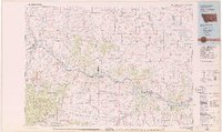
1979 Map of Big Timber
USGS Topo · Published 1979About this map
The Yellowstone River serves as the primary corridor for settlement and transit across this South Central Montana landscape, followed closely by the Burlington Northern railroad and Interstate 90. The town of Big Timber sits at the confluence with the Boulder River, acting as a hub for the surrounding ranching and timber country. To the south, the terrain rises sharply into the Gallatin National Forest and Custer National Forest, where peaks like Sugarloaf Mountain and Iron Mountain dominate the skyline.
Find a feature on this map
67 named features on this map. Tap any name to fly to it.
Don’t see what you’re looking for? This feature index may not catch every label — zoom into the map to look around manually.
Map Details
Editions of this 1979 Big Timber Map
This is the sole edition of this map. No revisions or reprints were ever made.
Other maps of this area

1886 · Little Belt Mts.
USGS Topo · 1:250,000

1889 · Big Snowy Mountain
USGS Topo · 1:250,000

1891 · Livingston
USGS Topo · 1:250,000

1891 · Big Timber
USGS Topo · 1:125,000

1892 · Stillwater
USGS Topo · 1:125,000

1893 · Livingston
USGS Topo · 1:250,000

1893 · Big Snowy Mountain
USGS Topo · 1:250,000

1893 · Big Timber
USGS Topo · 1:125,000

1894 · Little Belt Mts.
USGS Topo · 1:250,000

1897 · Little Belt Mts.
USGS Topo · 1:250,000