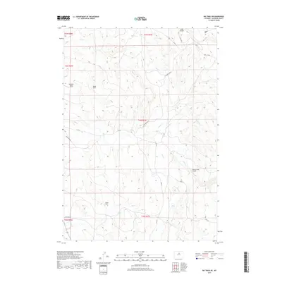
2017 Map of Big Trails NE
USGS Topo · Published 2017About this map
Red Reflet Ranch Airport and a network of remote ranching roads define this corner of Washakie County. The landscape is carved by deep drainages such as Cooks Canyon and Spring Creek Canyon, while the high ground is marked by prominent landmarks like Cooks Vee and Taylor Draw. Water sources are essential in this arid environment, with reliable points such as Taylor Spring and Coyote Spring recorded across the township lines. Regional movement follows the natural contours, with routes like Taylor Brothers Rd, Spring Creek Rd, and Mazet Rd connecting the scattered ranching operations. The drainage systems of Alkali Cr and Spring Cr illustrate the complex watershed that dictates the layout of human activity in this part of the Big Horn Basin.
Find a feature on this map
27 named features on this map. Tap any name to fly to it.
Don’t see what you’re looking for? This feature index may not catch every label — zoom into the map to look around manually.
Map Details
Editions of this 2017 Big Trails NE Map
This is the sole edition of this map. No revisions or reprints were ever made.
Other maps of this area

1899 · Cloud peak
USGS Topo · 1:125,000

1901 · Cloud Peak
USGS Topo · 1:125,000

1955 · Sheridan
USGS Topo · 1:250,000

1955 · Arminto
USGS Topo · 1:250,000

1958 · Sheridan
USGS Topo · 1:250,000

1958 · Arminto
USGS Topo · 1:250,000

1962 · Sheridan
USGS Topo · 1:250,000

1962 · Arminto
USGS Topo · 1:250,000

1966 · Monument Hill
USGS Topo · 1:24,000

1966 · Big Trails
USGS Topo · 1:24,000