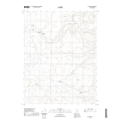
2020 Map of Big Triangle
USGS Topo · Published 2020About this map
The Colorado River carves a deep path through Grand County in this modern survey, revealing the complex drainage systems of the high desert. This stretch of the river is punctuated by named whitewater features including Skull Rapids, Sock-It-To-Me Rapids, and Last Chance Rapids, indicating the significant elevation changes within Westwater Canyon. The landscape is dominated by expansive plateaus and mesa-like formations, most notably Big Triangle and Little Triangle, which are separated by a network of seasonal watercourses such as Renegade Cr and Ryan Cr. Evidence of the region’s topography is further illustrated by features like Sand Flat and Grand Valley, while smaller tributaries like Agate Wash and Cottonwood Wash feed into the primary river corridor. This map highlights the area's transition from broad flats to the narrow, restricted passages of Star Canyon and Trail Canyon, characteristic of the Colorado Plateau's erosional history.
Find a feature on this map
23 named features on this map. Tap any name to fly to it.
Don’t see what you’re looking for? This feature index may not catch every label — zoom into the map to look around manually.
Map Details
Editions of this 2020 Big Triangle Map
This is the sole edition of this map. No revisions or reprints were ever made.
Other maps of this area

1885 · East Tavaputs
USGS Topo · 1:250,000

1885 · La Sal
USGS Topo · 1:250,000

1954 · Westwater 4 SW
USGS Topo · 1:24,000

1954 · Mt. Waas 1 SW
USGS Topo · 1:24,000

1954 · Mt. Waas 1 NE
USGS Topo · 1:24,000

1954 · Mt. Waas 1 NW
USGS Topo · 1:24,000

1954 · Mt. Waas 1 SE
USGS Topo · 1:24,000

1954 · Coates Creek
USGS Topo · 1:62,500

1955 · Mt. Waas 2 SE
USGS Topo · 1:24,000

1956 · Westwater 4 SE
USGS Topo · 1:24,000