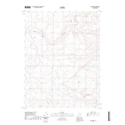
2023 Map of Big Triangle
USGS Topo · Published 2023About this map
The Colorado River carves a deep, winding path through this corner of Grand County, Utah, defined by a series of named whitewater challenges including Skull Rapids, Funnel Falls, and Sock-It-To-Me Rapids. The river course is flanked by dramatic elevation shifts through Westwater Canyon and Star Canyon, creating a landscape dominated by high plateaus and drainage systems. To the south, the prominent geological formations of Big Triangle and Little Triangle rise above the confluence of seasonal watercourses like Coach Creek and Ryan Creek.
Find a feature on this map
25 named features on this map. Tap any name to fly to it.
Don’t see what you’re looking for? This feature index may not catch every label — zoom into the map to look around manually.
Map Details
Editions of this 2023 Big Triangle Map
This is the sole edition of this map. No revisions or reprints were ever made.
Other maps of this area

1885 · East Tavaputs
USGS Topo · 1:250,000

1885 · La Sal
USGS Topo · 1:250,000

1954 · Westwater 4 SW
USGS Topo · 1:24,000

1954 · Mt. Waas 1 SW
USGS Topo · 1:24,000

1954 · Mt. Waas 1 NE
USGS Topo · 1:24,000

1954 · Mt. Waas 1 NW
USGS Topo · 1:24,000

1954 · Mt. Waas 1 SE
USGS Topo · 1:24,000

1954 · Coates Creek
USGS Topo · 1:62,500

1955 · Mt. Waas 2 SE
USGS Topo · 1:24,000

1956 · Westwater 4 SE
USGS Topo · 1:24,000