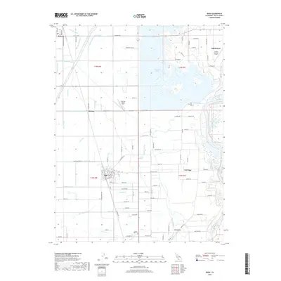
2018 Map of Biggs
USGS Topo · Published 2018About this map
Agricultural irrigation systems define the landscape around Biggs and Richvale in this 2018 survey of Butte County. A complex network of water infrastructure, including the Main Drainage Canal, Burns Government Lateral, and Butler Canal, supports the region's productive farmlands. The massive Thermalito Afterbay dominates the northern portion of the map, serving as a critical component of the area's water management system before the terrain slopes toward the Feather River in the east.
Find a feature on this map
120 named features on this map. Tap any name to fly to it.
Don’t see what you’re looking for? This feature index may not catch every label — zoom into the map to look around manually.
Map Details
Editions of this 2018 Biggs Map
This is the sole edition of this map. No revisions or reprints were ever made.
Other maps of this area

1888 · Marysville
USGS Topo · 1:125,000

1891 · Chico
USGS Topo · 1:125,000

1891 · Marysville
USGS Topo · 1:125,000

1893 · Chico
USGS Topo · 1:125,000

1894 · Marysville
USGS Topo · 1:125,000

1895 · Marysville
USGS Topo · 1:125,000

1895 · Chico
USGS Topo · 1:125,000

1911 · Landlow
USGS Topo · 1:31,680

1912 · Dry Creek
USGS Topo · 1:31,680

1912 · Oroville
USGS Topo · 1:31,680