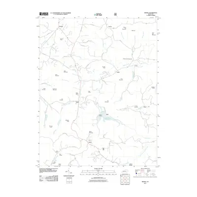
2011 Map of Bighill
USGS Topo · Published 2011About this map
Bighill and the surrounding southern reaches of Madison County are defined by a complex network of knobs and hollows where the Bluegrass region meets the Appalachian foothills. This landscape is marked by prominent elevations like Indian Fort Mountain, East Pinnacle, and Pilot Knob, which overlook the winding drainage of Red Lick Creek and Joe Lick Fork. The map documents a rural character established around small settlements such as Morrill, Dreyfus, and Clover Bottom, where local life is tied to the valleys of the Ousley Fork and the South Fork Station Camp Creek.
Find a feature on this map
87 named features on this map. Tap any name to fly to it.
Don’t see what you’re looking for? This feature index may not catch every label — zoom into the map to look around manually.
Map Details
Editions of this 2011 Bighill Map
This is the sole edition of this map. No revisions or reprints were ever made.
Other maps of this area

1892 · Richmond
USGS Topo · 1:125,000

1893 · London
USGS Topo · 1:125,000

1897 · Richmond
USGS Topo · 1:125,000

1897 · London
USGS Topo · 1:125,000

1952 · Alcorn
USGS Topo · 1:24,000

1952 · Berea
USGS Topo · 1:24,000

1952 · Bighill
USGS Topo · 1:24,000

1952 · Panola
USGS Topo · 1:24,000

1952 · Moberly
USGS Topo · 1:24,000

1953 · Richmond South
USGS Topo · 1:24,000