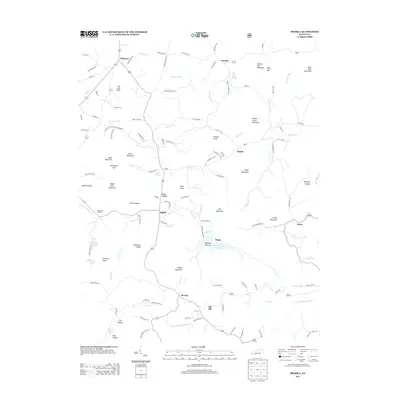
2013 Map of Bighill
USGS Topo · Published 2013About this map
Bighill stands at the crossroads of Kentucky's high knobs and valley creeks, serving as a focal point for this landscape of high ridges and hollows. The area is defined by its complex topography, where heights like Indian Fort Mountain and Big Mountain overlook drainage systems including Red Lick Cr and Owsley Fork. Cultural and recreational landmarks are prominent, notably the Indian Fort Theatre situated near the western peaks. Water resources are a defining characteristic of the region, anchored by the Owsley Fork Reservoir and Berea City Lakes. Smaller settlements such as Bobtown, Dreyfus, and Morrill are connected by a network of rural routes like Pilot Knob Cemetery Rd, which links family-named landmarks and local history. The presence of specialized sites like the Red Lick Sulphur Spring hints at the mineral-rich waters that have long been a feature of the Central Kentucky knobs.
Find a feature on this map
76 named features on this map. Tap any name to fly to it.
Don’t see what you’re looking for? This feature index may not catch every label — zoom into the map to look around manually.
Map Details
Editions of this 2013 Bighill Map
This is the sole edition of this map. No revisions or reprints were ever made.
Other maps of this area

1892 · Richmond
USGS Topo · 1:125,000

1893 · London
USGS Topo · 1:125,000

1897 · Richmond
USGS Topo · 1:125,000

1897 · London
USGS Topo · 1:125,000

1952 · Alcorn
USGS Topo · 1:24,000

1952 · Berea
USGS Topo · 1:24,000

1952 · Bighill
USGS Topo · 1:24,000

1952 · Panola
USGS Topo · 1:24,000

1952 · Moberly
USGS Topo · 1:24,000

1953 · Richmond South
USGS Topo · 1:24,000