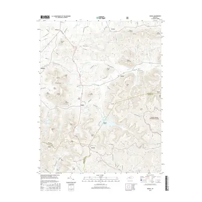
2016 Map of Bighill
USGS Topo · Published 2016About this map
Indian Ft Mtn and the twin peaks of West Pinnacle and East Pinnacle dominate the western horizon of this Kentucky landscape, marking the transition from the rolling lowlands near Berea into the elevated terrain of the Daniel Boone National Forest. The map documents a complex network of ridges and hollows, where family-named landmarks like Hacker Smith Mtn and Baker Hollow define the local geography. Water management is a central theme, evidenced by the Berea City Lakes and the Owsley Fork Reservoir, which collect runoff from the numerous creeks such as Red Lick Cr and Cowbell Cr. Settlements like Bighill, Morrill, and Bobtown are connected by winding routes like McKee Rd, while the presence of the Cox Cem and Red Lick Cem provides essential points of reference for genealogists studying the families that settled along the forks of Joe Lick Fork and Gravel Lick Br.
Find a feature on this map
99 named features on this map. Tap any name to fly to it.
Don’t see what you’re looking for? This feature index may not catch every label — zoom into the map to look around manually.
Map Details
Editions of this 2016 Bighill Map
This is the sole edition of this map. No revisions or reprints were ever made.
Other maps of this area

1892 · Richmond
USGS Topo · 1:125,000

1893 · London
USGS Topo · 1:125,000

1897 · Richmond
USGS Topo · 1:125,000

1897 · London
USGS Topo · 1:125,000

1952 · Alcorn
USGS Topo · 1:24,000

1952 · Berea
USGS Topo · 1:24,000

1952 · Bighill
USGS Topo · 1:24,000

1952 · Panola
USGS Topo · 1:24,000

1952 · Moberly
USGS Topo · 1:24,000

1953 · Richmond South
USGS Topo · 1:24,000