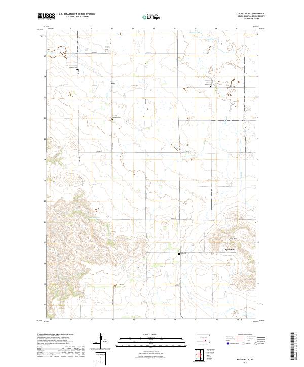
2021 Map of Bijou Hills
USGS Topo · Published 2021About this map
The Bijou Hills landform rises above the surrounding Brule County plains, serving as the central topographical anchor for this South Dakota landscape. The map reveals a deeply rooted immigrant history reflected in its cemeteries, including the Saint Venceslaus Bohemian National Cem and the Swedish Lutheran Cem. Small agricultural communities like Ola and the namesake Bijou Hills settlement are connected by a rigid grid of rural section roads, such as 260th St and 350th Ave. Water features are scarce but vital, with drainage provided by Elm Cr and Nelson Cr, while America Lake and the Panzour Dam represent important local water management. This 2021 survey illustrates how the township and range system has organized the prairie, with family and denominational ties still etched into the land via sites like Amunid Emmanual Lutheran Cem and German Lutheran Cem.
Find a feature on this map
28 named features on this map. Tap any name to fly to it.
Don’t see what you’re looking for? This feature index may not catch every label — zoom into the map to look around manually.
Map Details
Editions of this 2021 Bijou Hills Map
This is the sole edition of this map. No revisions or reprints were ever made.
Other maps of this area

1940 · Iona
USGS Topo · 1:62,500

1944 · Iona
USGS Topo · 1:62,500

1955 · Mitchell
USGS Topo · 1:250,000

1959 · Mitchell
USGS Topo · 1:250,000

1971 · Lucas NW
USGS Topo · 1:24,000

1971 · Academy
USGS Topo · 1:24,000

1971 · Dixon NE
USGS Topo · 1:24,000
1974 · Bond Bottom
USGS Topo · 1:24,000

1974 · Red Lake West
USGS Topo · 1:24,000

1979 · Bijou Hills NE
USGS Topo · 1:24,000