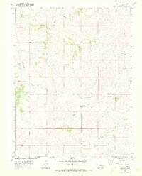
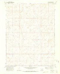
1970 Map of Bijou SW
USGS Topo · Published 1973About this map
Middle Bijou Creek and its seasonal tributaries carve a network of drainages across this section of Elbert County, defining a landscape of high plains ranching. The 1970 field check reveals the specialized aviation and communication infrastructure of the era, including the private Landing Strips at Brittingham Ranch and a nearby Radio Facility. These modern additions sit alongside older landmarks of the rural community, such as the Norton Cem and the small settlement of Minter. The prominence of Road Ridge and the winding courses of Bland Creek and Wilson Creek illustrate how the natural topography dictated the placement of early roads and homesteads. This map provides a clear record of the intersection between traditional livestock ranching and the technological developments of the mid-twentieth century.
Find a feature on this map
14 named features on this map. Tap any name to fly to it.
Don’t see what you’re looking for? This feature index may not catch every label — zoom into the map to look around manually.
Map Details
Editions of this 1970 Bijou SW Map
2 editions found
Other maps of this area

1953 · Denver
USGS Topo · 1:250,000

1957 · Denver
USGS Topo · 1:250,000

1958 · Denver
USGS Topo · 1:250,000

1960 · Denver
USGS Topo · 1:250,000
1970 · Kiowa NE
USGS Topo · 1:24,000

1970 · Big Gulch
USGS Topo · 1:24,000
1970 · Cattle Gulch
USGS Topo · 1:24,000
1970 · Fondis
USGS Topo · 1:24,000
1970 · Bijou SW
USGS Topo · 1:24,000
1970 · Bijou
USGS Topo · 1:24,000