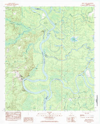
1983 Map of Bilbo Island
USGS Topo · Published 1983About this map
Alabama River and Tombigbee River converge in this hydrologically complex landscape, where the shifting waters define the boundaries of Clarke, Washington, Baldwin, and Mobile counties. The map documents a labyrinth of oxbow lakes, sloughs, and backwaters, including the distinctive Jim Burr Lake and Alligator Slide. This riverine environment supported local river navigation and small landings such as Blue Ford Landing and Laurel Shanty Landing, which served as critical access points in an otherwise inaccessible wetland. On higher ground away from the marshes, Friendship Ch stands as a focal point for the local community. The confluence eventually forms the Mobile River at the southern end of Bilbo Island, a massive landmass carved out by the Bilbo Creek and the Cutoff channel. This 1983 edition represents the area just as modern infrastructure like a major pipeline and powerlines began to cut across the historic river bends and ridges like Seaboard Bluff.
Find a feature on this map
37 named features on this map. Tap any name to fly to it.
Don’t see what you’re looking for? This feature index may not catch every label — zoom into the map to look around manually.
Map Details
Editions of this 1983 Bilbo Island Map
2 editions found
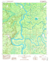
Other maps of this area

1943 · Choctaw Bluff
USGS Topo · 1:62,500

1943 · Tensaw
USGS Topo · 1:62,500

1943 · Citronelle
USGS Topo · 1:62,500

1943 · McIntosh
USGS Topo · 1:62,500

1944 · McIntosh
USGS Topo · 1:62,500

1944 · Tensaw
USGS Topo · 1:62,500

1946 · Citronelle
USGS Topo · 1:62,500

1946 · Choctaw Bluff
USGS Topo · 1:62,500

1953 · Andalusia
USGS Topo · 1:250,000

1953 · Hattiesburg
USGS Topo · 1:250,000