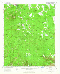
1962 Map of Bill Williams Mtn
USGS Topo · Published 1964About this map
Williams serves as the focal point of this northern Arizona landscape, situated at the base of Bill Williams Mountain. In the early 1960s, the town was a critical node for the Atchison Topeka and Santa Fe railroad, which branches here at Williams Junction. The terrain is characterized by a complex network of volcanic features and water management, including the Saginaw Reservoirs, City Reservoir, and the Dogtown Reservoir. Local history is reflected in several established cattle and sheep operations such as Benham Ranch, Shiner Ranch, and the Pouquette Homestead Tank. The map reveals the infrastructure of the era with numerous gravel pits, cinder pits, and radio towers atop the mountain peaks. High-elevation landmarks like High School Hill and Summit Mountain tower over the surrounding Kaibab National Forest, while the presence of cemeteries and remote cliff dwellings offer points of interest for genealogists and researchers.
Find a feature on this map
138 named features on this map. Tap any name to fly to it.
Don’t see what you’re looking for? This feature index may not catch every label — zoom into the map to look around manually.
Map Details
Editions of this 1962 Bill Williams Mtn Map
3 editions found
Other maps of this area

1886 · San Francisco Mtns
USGS Topo · 1:250,000

1886 · Chino
USGS Topo · 1:250,000

1887 · Verde
USGS Topo · 1:250,000

1887 · Prescott
USGS Topo · 1:250,000

1891 · San Francisco Mtns
USGS Topo · 1:250,000

1891 · Chino
USGS Topo · 1:250,000

1892 · Verde
USGS Topo · 1:250,000

1892 · Prescott
USGS Topo · 1:250,000

1894 · San Francisco Mtns
USGS Topo · 1:250,000

1899 · San Francisco Mtns
USGS Topo · 1:250,000