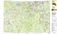
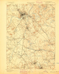
1987 Map of Billerica
USGS Topo · Published 1987About this map
The Concord River flows northward through this late twentieth-century landscape, carving a path between the established industrial and residential centers of Billerica and Lowell. The map illustrates a region in transition, where colonial-era landmarks like the Forefathers Burying Ground and Hillside Cem sit alongside modern highway infrastructure, including numerous interchanges along the suburban corridors of Chelmsford and Westford. The presence of the House of Correction in South Lowell and the Middlesex Community College campus near Bedford Springs highlights the civic and educational development of Middlesex County.
Find a feature on this map
111 named features on this map. Tap any name to fly to it.
Don’t see what you’re looking for? This feature index may not catch every label — zoom into the map to look around manually.
Map Details
Editions of this 1987 Billerica Map
This is the sole edition of this map. No revisions or reprints were ever made.
Other maps of this area
1886 · Lawrence
USGS Topo · 1:62,500

1886 · Lowell
USGS Topo · 1:62,500

1886 · Framingham
USGS Topo · 1:62,500

1887 · Marlboro
USGS Topo · 1:62,500
1888 · Lawrence
USGS Topo · 1:62,500

1889 · Marlboro
USGS Topo · 1:62,500

1889 · Framingham
USGS Topo · 1:62,500
1893 · Lowell
USGS Topo · 1:62,500

1893 · Boston
USGS Topo · 1:62,500
1893 · Lawrence
USGS Topo · 1:62,500