
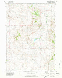
2012 Map of Bills Creek
USGS Topo · Published 2012About this map
Jireh Cem and the settlement of Monte Edwards anchor the southwestern portion of this high plains landscape, situated along the corridor of Jireh Rd. The terrain is defined by the drainage systems of Bills Creek and Middle Creek, which flow through the undulating land toward the Niobrara River in the east. Notable topographic features include the Horseshoe Hills and Shelton Peak, providing distinct landmarks for those tracing land ownership or historical routes in Niobrara County.
Find a feature on this map
18 named features on this map. Tap any name to fly to it.
Don’t see what you’re looking for? This feature index may not catch every label — zoom into the map to look around manually.
Map Details
Editions of this 2012 Bills Creek Map
This is the sole edition of this map. No revisions or reprints were ever made.
Other maps of this area

1950 · Prairie View School
USGS Topo · 1:24,000

1954 · Torrington
USGS Topo · 1:250,000

1958 · Torrington
USGS Topo · 1:250,000

1970 · Cooley Draw
USGS Topo · 1:24,000

1970 · Keeline
USGS Topo · 1:24,000

1974 · Lone Tree Hill
USGS Topo · 1:24,000

1974 · Silver Springs
USGS Topo · 1:24,000

1981 · Manville
USGS Topo · 1:24,000

1981 · Bills Creek
USGS Topo · 1:24,000
1981 · Manville NE
USGS Topo · 1:24,000