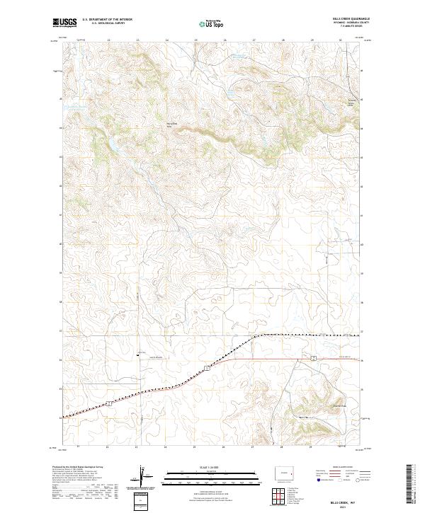
2021 Map of Bills Creek
USGS Topo · Published 2021About this map
Horseshoe Hills and the Seventy-Seven Hills dominate the high plains of Niobrara County, where the drainage of Bills Cr and Lance Cr carves a complex network of draws and ridges. This modern survey illustrates a landscape defined by ranching and resource management, anchored by features like the Lance Cr Number 2 Reservoir and vital water sources such as Four-Hundred Acre Spring and Middle Creek Spring.
Find a feature on this map
26 named features on this map. Tap any name to fly to it.
Don’t see what you’re looking for? This feature index may not catch every label — zoom into the map to look around manually.
Map Details
Editions of this 2021 Bills Creek Map
This is the sole edition of this map. No revisions or reprints were ever made.
Other maps of this area

1950 · Prairie View School
USGS Topo · 1:24,000

1954 · Torrington
USGS Topo · 1:250,000

1958 · Torrington
USGS Topo · 1:250,000

1970 · Cooley Draw
USGS Topo · 1:24,000

1970 · Keeline
USGS Topo · 1:24,000

1974 · Lone Tree Hill
USGS Topo · 1:24,000

1974 · Silver Springs
USGS Topo · 1:24,000

1981 · Manville
USGS Topo · 1:24,000

1981 · Bills Creek
USGS Topo · 1:24,000
1981 · Manville NE
USGS Topo · 1:24,000