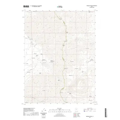
2020 Map of Bingham Canyon
USGS Topo · Published 2020About this map
The Oquirrh Mountains form a high-altitude spine along the border of Tooele and Salt Lake counties, punctuated by significant summits like Nelson Peak and Clipper Peak. This industrial and wilderness landscape is deeply tied to the regional mining history, as evidenced by the Utah Metal Company Tunnel cutting through the peaks. In the southeastern portion of the map, the headwaters of Bingham Canyon and its associated Dry Fork Bingham Canyon reveal the complex topography of a world-famous mining district. A single cemetery, Chandler Cem, sits near the forks of the canyon, providing a small but vital link for genealogists tracking the families who lived and worked in these steep drainage systems. Primitive and secondary roads such as Anaconda Rd and Pole Line Rd follow the contours of the numerous hollows and gulches, including Bear Hollow and Baltimore Gulch.
Find a feature on this map
46 named features on this map. Tap any name to fly to it.
Don’t see what you’re looking for? This feature index may not catch every label — zoom into the map to look around manually.
Map Details
Editions of this 2020 Bingham Canyon Map
This is the sole edition of this map. No revisions or reprints were ever made.
Other maps of this area

1885 · Tooele Valley
USGS Topo · 1:250,000

1915 · Fairfield
USGS Topo · 1:62,500

1917 · Fairfield
USGS Topo · 1:62,500

1918 · Stockton
USGS Topo · 1:62,500

1952 · Magna
USGS Topo · 1:24,000

1952 · Bingham Canyon
USGS Topo · 1:24,000
1952 · Lark
USGS Topo · 1:24,000

1952 · Garfield
USGS Topo · 1:24,000

1953 · Tooele
USGS Topo · 1:250,000
1954 · Tickville Spring
USGS Topo · 1:24,000