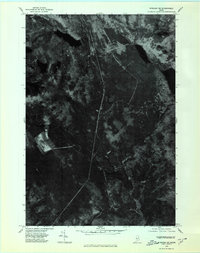
1975 Map of Bingham NE
USGS Topo · Published 1980About this map
Austin Stream carves a path through this part of Somerset County, reflecting the timbered landscape of the Maine woods during the mid-1970s. This orthophotograph, captured from an October 1975 aerial survey, provides a literal overhead perspective of the terrain rather than the traditional symbolic representation of a standard topographic map. The imagery reveals the density of the forest surrounding Austin Pond and its smaller neighbor, Little Austin Pond, while also showing the clearings and logging roads that define the regional economy. To the west, the slopes of Dimmick Mountain rise above Dimmick Pond, illustrating the typical drainage patterns of the Kennebec watershed. This map is a valuable resource for those studying land use and forest management in Maine, capturing the precise state of the backcountry before subsequent decades of growth and logging reshaped the canopy.
Find a feature on this map
5 named features on this map. Tap any name to fly to it.
Don’t see what you’re looking for? This feature index may not catch every label — zoom into the map to look around manually.
Map Details
Editions of this 1975 Bingham NE Map
This is the sole edition of this map. No revisions or reprints were ever made.
Other maps of this area

1903 · Bingham
USGS Topo · 1:62,500

1905 · Bingham
USGS Topo · 1:62,500

1905 · The Forks
USGS Topo · 1:62,500

1907 · The Forks
USGS Topo · 1:62,500

1948 · Kingsbury
USGS Topo · 1:62,500

1950 · Kingsbury
USGS Topo · 1:62,500

1951 · Greenville
USGS Topo · 1:62,500

1954 · Millinocket
USGS Topo · 1:250,000

1956 · The Forks
USGS Topo · 1:62,500

1956 · Bingham
USGS Topo · 1:62,500