
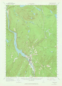
1956 Map of Bingham
USGS Topo · Published 1962About this map
The industrial and recreational landscape of Somerset County unfolds along the Kennebec River in the mid-1950s. The central feature is Wyman Lake, created by the damming of the river, with its Hydroelectric Plant located just north of the settlement at Bingham. This period shows the transition between a river-driven economy and modern infrastructure, where a Gaging Station monitors the water levels and the Appalachian Trail winds through the hills west of the reservoir. Local education and community life are represented by the Longfellow Sch and Union Cem. To the north, the geography is dominated by large water bodies like Moxie Pond and Pleasant Pond, alongside numerous smaller ponds such as Big Dimmick Pond and the Heald Ponds, which define the timber and sporting character of the region.
Find a feature on this map
98 named features on this map. Tap any name to fly to it.
Don’t see what you’re looking for? This feature index may not catch every label — zoom into the map to look around manually.
Map Details
Editions of this 1956 Bingham Map
2 editions found
Other maps of this area

1903 · Bingham
USGS Topo · 1:62,500

1904 · Anson
USGS Topo · 1:62,500

1905 · Bingham
USGS Topo · 1:62,500

1905 · The Forks
USGS Topo · 1:62,500

1907 · The Forks
USGS Topo · 1:62,500

1913 · Skowhegan
USGS Topo · 1:62,500

1925 · Pierce Pond
USGS Topo · 1:48,000

1927 · Pierce Pond
USGS Topo · 1:62,500

1928 · Dead River
USGS Topo · 1:62,500

1930 · Kingfield
USGS Topo · 1:48,000