
1948 Map of Bingham
USGS Topo · Published 1963About this map
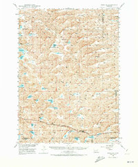
Bingham serves as the primary hub for this stretch of the Nebraska Sandhills, anchored by the Chicago Burlington and Quincy railroad line. The settlement pattern here is dictated by the unique interdunal basins, where water collects in numerous shallow lakes such as Wintermuth Lake, Watson Lake, and Von Krosigh Lake. These water sources support isolated ranching operations like the Lambert Ranch, while local education was once decentralized across several rural campuses including School No 156 and Burton Sch.
Find a feature on this map
38 named features on this map. Tap any name to fly to it.
Don’t see what you’re looking for? This feature index may not catch every label — zoom into the map to look around manually.
Map Details
Editions of this 1948 Bingham Map
2 editions found
Other maps of this area

1948 · Ashby
USGS Topo · 1:62,500

1948 · Lakeside
USGS Topo · 1:62,500

1948 · Twin Lakes
USGS Topo · 1:62,500

1948 · Spade Ranch
USGS Topo · 1:62,500

1948 · George Lake
USGS Topo · 1:62,500

1949 · Ashby
USGS Topo · 1:62,500

1949 · Mumper
USGS Topo · 1:62,500

1949 · Turpin Lake
USGS Topo · 1:62,500

1950 · Twin Lakes
USGS Topo · 1:62,500

1950 · George Lake
USGS Topo · 1:62,500