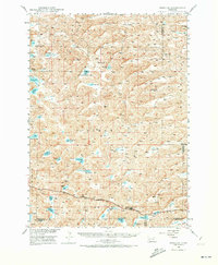
1948 Map of Bingham
USGS Topo · Published 1973About this map
The high plains of Sheridan County at the mid-century are defined here by an intricate system of ephemeral lakes and ranching landmarks. The Chicago Burlington and Quincy railroad cuts through the southern portion of the map, serving as the primary transport artery for the community of Bingham. Surrounding this rail corridor is a landscape dotted with numerous named water bodies, including Wintermuth Lake, Gronning Lake, and Von Krosigh Lake, which indicate the localized drainage patterns of the Sandhills region.
Find a feature on this map
38 named features on this map. Tap any name to fly to it.
Don’t see what you’re looking for? This feature index may not catch every label — zoom into the map to look around manually.
Map Details
Editions of this 1948 Bingham Map
2 editions found
Other maps of this area

1948 · Ashby
USGS Topo · 1:62,500

1948 · Bingham
USGS Topo · 1:62,500

1948 · Lakeside
USGS Topo · 1:62,500

1948 · Twin Lakes
USGS Topo · 1:62,500

1948 · Spade Ranch
USGS Topo · 1:62,500

1948 · George Lake
USGS Topo · 1:62,500

1949 · Ashby
USGS Topo · 1:62,500

1949 · Mumper
USGS Topo · 1:62,500

1949 · Turpin Lake
USGS Topo · 1:62,500

1950 · Twin Lakes
USGS Topo · 1:62,500