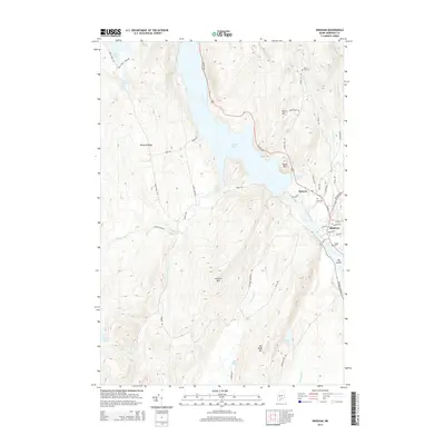
2014 Map of Bingham
USGS Topo · Published 2014About this map
Wyman Lake dominates the central landscape of this Somerset County quadrangle, where the Kennebec River corridor shapes the local geography and settlement patterns. The village of Bingham sits on the eastern bank at the confluence of several streams, serving as a focal point for the region's road network, including Canada Rd and Main St. Historical interest is found in the scattered rural cemeteries, such as Union Cem and Village Cem, which anchor the early community centers of Moscow and the surrounding highlands. The terrain rises sharply from the river valley to prominent peaks like Baker Mtn and Fletcher Mtn, while interior water bodies including Temple Pond and Rowe Pond are connected by a network of timber and access roads like Rowe Pond Rd.
Find a feature on this map
60 named features on this map. Tap any name to fly to it.
Don’t see what you’re looking for? This feature index may not catch every label — zoom into the map to look around manually.
Map Details
Editions of this 2014 Bingham Map
This is the sole edition of this map. No revisions or reprints were ever made.
Other maps of this area

1903 · Bingham
USGS Topo · 1:62,500

1904 · Anson
USGS Topo · 1:62,500

1905 · Bingham
USGS Topo · 1:62,500

1928 · Dead River
USGS Topo · 1:62,500

1930 · Kingfield
USGS Topo · 1:48,000

1931 · Dead River
USGS Topo · 1:48,000

1932 · Kingfield
USGS Topo · 1:62,500

1944 · Dead River
USGS Topo · 1:62,500

1948 · Bangor
USGS Topo · 1:250,000

1949 · Jackman
USGS Topo · 1:250,000