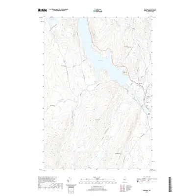
2018 Map of Bingham
USGS Topo · Published 2018About this map
Wyman Lake dominates the central corridor of this Somerset County landscape, a significant widening of the Kennebec River that defines the local geography. On the eastern shore, the town of Moscow is situated along the riverbanks, where early 21st-century residential patterns are clustered near the junction of Station Rd and Austin Stream. The terrain rises sharply away from the water toward Baker Mtn and Fletcher Mtn, revealing a network of logging and local access roads like Carry Pond Rd and Fletcher Mountain Rd.
Find a feature on this map
55 named features on this map. Tap any name to fly to it.
Don’t see what you’re looking for? This feature index may not catch every label — zoom into the map to look around manually.
Map Details
Editions of this 2018 Bingham Map
This is the sole edition of this map. No revisions or reprints were ever made.
Other maps of this area

1903 · Bingham
USGS Topo · 1:62,500

1904 · Anson
USGS Topo · 1:62,500

1905 · Bingham
USGS Topo · 1:62,500

1928 · Dead River
USGS Topo · 1:62,500

1930 · Kingfield
USGS Topo · 1:48,000

1931 · Dead River
USGS Topo · 1:48,000

1932 · Kingfield
USGS Topo · 1:62,500

1944 · Dead River
USGS Topo · 1:62,500

1948 · Bangor
USGS Topo · 1:250,000

1949 · Jackman
USGS Topo · 1:250,000