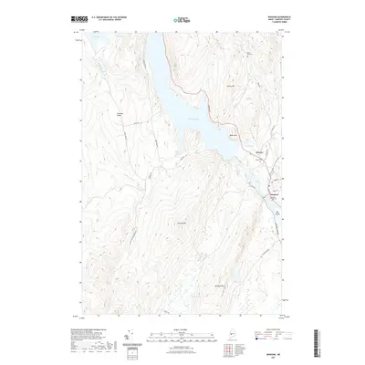
2021 Map of Bingham
USGS Topo · Published 2021About this map
The Kennebec River corridor defines the landscape of central Somerset County, where the village of Bingham serves as a focal point for the surrounding highlands. The river's path is marked by significant features like Big Island and the expansive waters of Wyman Lake, which fills the valley between Moscow and the western ridges. Higher elevations are dominated by summits such as Fletcher Mtn, Baker Mtn, and Old Bluff Mtn, providing a stark contrast to the settled riverbanks. For those tracing local history and family lineages, several burial grounds are documented, including Bingham Village Cem, Union Cem, and Pierce Hill Cem. The map detail shows the transition from the concentrated street grid of Bingham, featuring Main St and Murray St, to the more rural stretches of Pleasant Ridge and the winding course of Houston Brook toward its namesake Houston Brook Falls.
Find a feature on this map
34 named features on this map. Tap any name to fly to it.
Don’t see what you’re looking for? This feature index may not catch every label — zoom into the map to look around manually.
Map Details
Editions of this 2021 Bingham Map
This is the sole edition of this map. No revisions or reprints were ever made.
Other maps of this area

1903 · Bingham
USGS Topo · 1:62,500

1904 · Anson
USGS Topo · 1:62,500

1905 · Bingham
USGS Topo · 1:62,500

1928 · Dead River
USGS Topo · 1:62,500

1930 · Kingfield
USGS Topo · 1:48,000

1931 · Dead River
USGS Topo · 1:48,000

1932 · Kingfield
USGS Topo · 1:62,500

1944 · Dead River
USGS Topo · 1:62,500

1948 · Bangor
USGS Topo · 1:250,000

1949 · Jackman
USGS Topo · 1:250,000