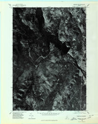
1975 Map of Bingham SW
USGS Topo · Published 1980About this map
Bingham and Moscow anchor this 1975 orthophotoquad, which uses rectified aerial imagery to capture the upper Kennebec River valley in Somerset County. Unlike traditional line-drawn maps, this photo-based record reveals the literal footprint of the landscape, showing the dense forest cover and precise topography of Old Bluff Mountain and Fletcher. The distinct photographic contrast highlights the confluence of Austin Stream and Martin Stream, as well as the industrial and residential development along the river. This specific format is invaluable for researchers tracing mid-1970s land use, timber clearings, and the exact state of local roads and structures before further modernization shaped the river towns.
Find a feature on this map
7 named features on this map. Tap any name to fly to it.
Don’t see what you’re looking for? This feature index may not catch every label — zoom into the map to look around manually.
Map Details
Editions of this 1975 Bingham SW Map
This is the sole edition of this map. No revisions or reprints were ever made.
Other maps of this area

1903 · Bingham
USGS Topo · 1:62,500

1904 · Anson
USGS Topo · 1:62,500

1905 · Bingham
USGS Topo · 1:62,500

1928 · Dead River
USGS Topo · 1:62,500

1930 · Kingfield
USGS Topo · 1:48,000

1931 · Dead River
USGS Topo · 1:48,000

1932 · Kingfield
USGS Topo · 1:62,500

1944 · Dead River
USGS Topo · 1:62,500

1948 · Bangor
USGS Topo · 1:250,000

1949 · Jackman
USGS Topo · 1:250,000