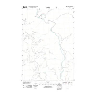
2011 Map of Bird Creek
USGS Topo · Published 2011About this map
The Salmon River carves a winding path through this Lemhi County landscape, defining the character of the terrain as it flows past the Maxwell Brg. Early transportation routes and historical pathways are evident, notably the Lewis and Clark Trl which skirts the northern reaches of the quadrangle. High on the western ridges, the Sims Mine indicates the region’s mineral history, while a network of forest service roads like Moose Creek Rd and Diamond Crk Rd provide access to the steep drainage basins of Bird Creek and Diamond Creek. To the southeast, the terrain softens into Big Flat, where agricultural development is supported by irrigation features such as the McNutt Ditch and Big Flat Ditch, showcasing the local adaptation to this arid mountainous environment.
Find a feature on this map
30 named features on this map. Tap any name to fly to it.
Don’t see what you’re looking for? This feature index may not catch every label — zoom into the map to look around manually.
Map Details
Editions of this 2011 Bird Creek Map
This is the sole edition of this map. No revisions or reprints were ever made.
Other maps of this area

1950 · Salmon
USGS Topo · 1:62,500

1950 · Leesburg
USGS Topo · 1:62,500

1951 · Leesburg
USGS Topo · 1:62,500

1951 · Salmon
USGS Topo · 1:62,500

1955 · Dillon
USGS Topo · 1:250,000

1956 · Elk City
USGS Topo · 1:250,000

1957 · Dillon
USGS Topo · 1:250,000

1958 · Dillon
USGS Topo · 1:250,000

1960 · Elk City
USGS Topo · 1:250,000

1960 · Ulysses Mtn
USGS Topo · 1:62,500