
1950 Map of Leesburg
USGS Topo · Published 1967About this map
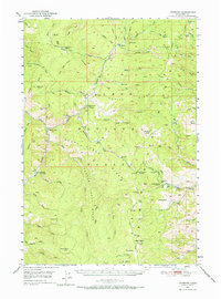
Leesburg and the surrounding Salmon River Mountains are defined by their deep mining heritage in this mid-century survey. The landscape is marked by numerous inactive operations, including the Italian Mine and the Ringbone Cayuse Mine, reflecting a transition from the area's peak extraction years toward forest management. The Blackbird Townsite stands as a focal point of settlement, while isolated outposts like the Williams Creek Guard Station and Cougar Point Camp indicate the role of the national forest in the local economy. From the Jureano Placer Diggings to the small Cem near the main settlement, the map provides a look at a landscape where gold and mineral prospects shaped the terrain. Water sources such as Arnett Creek and Napias Creek provided the necessary resources for both mining and the small livestock operations found at Peterson Ranch.
Find a feature on this map
69 named features on this map. Tap any name to fly to it.
Don’t see what you’re looking for? This feature index may not catch every label — zoom into the map to look around manually.
Map Details
Editions of this 1950 Leesburg Map
2 editions found
Other maps of this area

1950 · Blackbird Mtn
USGS Topo · 1:62,500

1950 · Salmon
USGS Topo · 1:62,500

1951 · Leesburg
USGS Topo · 1:62,500

1951 · Blackbird Mtn
USGS Topo · 1:62,500

1951 · Salmon
USGS Topo · 1:62,500

1955 · Dubois
USGS Topo · 1:250,000

1955 · Dillon
USGS Topo · 1:250,000

1956 · Elk City
USGS Topo · 1:250,000

1957 · Dillon
USGS Topo · 1:250,000

1957 · Challis
USGS Topo · 1:250,000