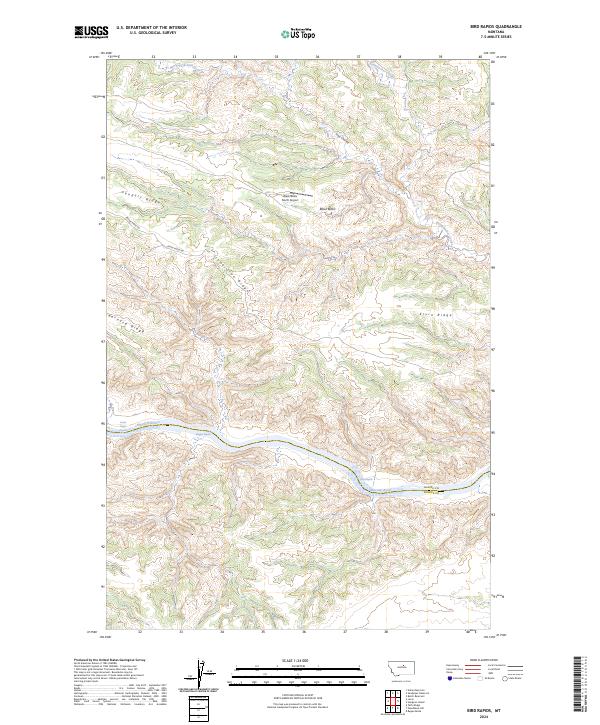
2024 Map of Bird Rapids
USGS Topo · Published 2024About this map
The Missouri River carves a deep, winding path through the heart of the Upper Missouri River Breaks National Monument on the border of Blaine and Fergus counties. This landscape is defined by its dramatic verticality, where the river sits over a thousand feet below the high plateaus of Pendell Ridge and Ervin Ridge. Navigation along this protected stretch of the Missouri Wild and Scenic River is marked by the turbulent waters of Bird Rapids and Magpie Rapids, which remain significant landmarks for river travelers today.
Find a feature on this map
24 named features on this map. Tap any name to fly to it.
Don’t see what you’re looking for? This feature index may not catch every label — zoom into the map to look around manually.
Map Details
Editions of this 2024 Bird Rapids Map
This is the sole edition of this map. No revisions or reprints were ever made.
Other maps of this area

1954 · Taffy Ridge
USGS Topo · 1:24,000

1954 · Bird Rapids
USGS Topo · 1:24,000

1954 · Leroy
USGS Topo · 1:24,000

1954 · Sturgeon Island
USGS Topo · 1:24,000

1954 · Lewistown
USGS Topo · 1:250,000

1959 · Lewistown
USGS Topo · 1:250,000
1985 · Nolan Reservoir
USGS Topo · 1:24,000

1985 · Woodhawk Hill
USGS Topo · 1:24,000
1985 · Sandpiper Reservoir
USGS Topo · 1:24,000
1985 · Butch Reservoir
USGS Topo · 1:24,000