
1954 Map of Sturgeon Island
USGS Topo · Published 1956About this map
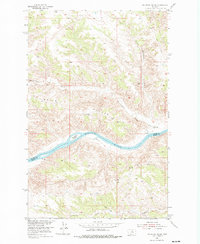
The Missouri River snakes through the center of this 1954 survey, defining the boundary between Blaine County and Fergus County. Centered on Sturgeon Island, the map reveals a landscape dominated by dramatic elevation changes and drainage networks like Bullwhacker Creek and Woodhawk Creek. This survey was conducted as part of a Department of the Interior program for the development of the Missouri River Basin, capturing the terrain shortly after aerial photography was utilized for topographic mapping in the region.
Find a feature on this map
8 named features on this map. Tap any name to fly to it.
Don’t see what you’re looking for? This feature index may not catch every label — zoom into the map to look around manually.
Map Details
Editions of this 1954 Sturgeon Island Map
2 editions found
Other maps of this area

1943 · Landusky
USGS Topo · 1:125,000

1954 · Bird Rapids
USGS Topo · 1:24,000

1954 · Cow Island
USGS Topo · 1:24,000

1954 · Baker Monument
USGS Topo · 1:24,000

1954 · Lewistown
USGS Topo · 1:250,000

1959 · Lewistown
USGS Topo · 1:250,000
1971 · John Coulee
USGS Topo · 1:24,000

1984 · Zortman
USGS Topo · 1:100,000

1985 · Woodhawk Hill
USGS Topo · 1:24,000
1985 · Sandpiper Reservoir
USGS Topo · 1:24,000