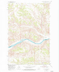
1954 Map of Sturgeon Island
USGS Topo · Published 1976About this map
The Missouri River winds through this central Montana landscape, marking the boundary between Blaine County and Fergus County during the mid-1950s. The topography is dominated by the sharp elevation changes of Ervin Ridge and the complex drainage systems of Bullwhacker Creek and Little Bullwhacker Creek. This survey was conducted as part of a Department of the Interior program for the development of the Missouri River Basin, documenting a period when the river's course still dictated the local geography and ranching patterns.
Find a feature on this map
9 named features on this map. Tap any name to fly to it.
Don’t see what you’re looking for? This feature index may not catch every label — zoom into the map to look around manually.
Map Details
Editions of this 1954 Sturgeon Island Map
2 editions found
Other maps of this area

1943 · Landusky
USGS Topo · 1:125,000

1954 · Bird Rapids
USGS Topo · 1:24,000

1954 · Cow Island
USGS Topo · 1:24,000

1954 · Baker Monument
USGS Topo · 1:24,000

1954 · Sturgeon Island
USGS Topo · 1:24,000

1954 · Lewistown
USGS Topo · 1:250,000

1959 · Lewistown
USGS Topo · 1:250,000
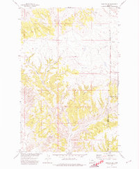
1971 · John Coulee
USGS Topo · 1:24,000

1984 · Zortman
USGS Topo · 1:100,000

1985 · Woodhawk Hill
USGS Topo · 1:24,000