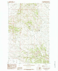
1985 Map of Nolan Reservoir
USGS Topo · Published 1985About this map
Leroy serves as the primary point of settlement on this high plains landscape in southern Blaine County, where the topography is defined by the drainage systems of the Milk River basin. The geography is marked by a series of coulees and branches, including the curiously named Coal Mine Coulee and Christenson Branch, which cut through the level terrain of Lone Tree Bench. In an area where water is a critical resource, Nolan Reservoir and Bear Paw Springs stand out as vital landmarks for local ranching operations. The presence of Lion Butte and the surrounding Lion Coulee indicates a shift toward more broken country in the southern portion of the quadrangle. This 1985 provisional survey captures the transition between open range and the specialized water management features necessary for sustaining life in this part of Montana.
Find a feature on this map
11 named features on this map. Tap any name to fly to it.
Don’t see what you’re looking for? This feature index may not catch every label — zoom into the map to look around manually.
Map Details
Editions of this 1985 Nolan Reservoir Map
This is the sole edition of this map. No revisions or reprints were ever made.
Other maps of this area

1953 · Havre
USGS Topo · 1:250,000

1954 · Bird Rapids
USGS Topo · 1:24,000

1954 · Leroy
USGS Topo · 1:24,000

1954 · Lewistown
USGS Topo · 1:250,000

1956 · Maddux
USGS Topo · 1:62,500

1956 · Rattlesnake
USGS Topo · 1:62,500

1957 · Havre
USGS Topo · 1:250,000

1958 · Havre
USGS Topo · 1:250,000

1959 · Lewistown
USGS Topo · 1:250,000

1964 · Ragland Bench
USGS Topo · 1:24,000