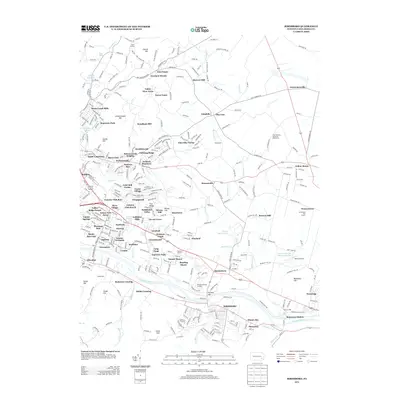
2013 Map of Birdsboro
USGS Topo · Published 2013About this map
The Schuylkill River and its accompanying Schuylkill Canal form the southern industrial and transport spine of this Berks County landscape. As of 2013, the region shows a dense suburban evolution from its agrarian roots, with numerous residential developments such as Grist Mill Farms, Jackson Meadows, and Glen Oley Farms filling the spaces between older centers like Saint Lawrence. Higher ground is marked by prominent elevations like Schwarzwald Hill and Monocacy Hill, while historic local landmarks like Spies Church and the Jean Bertolet Memorial Monument reflect long-standing community foundations. The landscape is also dotted with recreational and niche facilities, including Bert's Airport and the Arrowhead Golf Course, illustrating the modern transition of this river-valley corridor north of the river's bend.
Find a feature on this map
98 named features on this map. Tap any name to fly to it.
Don’t see what you’re looking for? This feature index may not catch every label — zoom into the map to look around manually.
Map Details
Editions of this 2013 Birdsboro Map
This is the sole edition of this map. No revisions or reprints were ever made.
Other maps of this area

1894 · Reading
USGS Topo · 1:62,500

1902 · Boyertown
USGS Topo · 1:62,500

1905 · Honey Brook
USGS Topo · 1:62,500

1906 · Phoenixville
USGS Topo · 1:62,500

1907 · Honeybrook
USGS Topo · 1:62,500

1913 · Reading
USGS Topo · 1:62,500

1915 · Reading
USGS Topo · 1:62,500

1941 · Honeybrook
USGS Topo · 1:62,500

1943 · Manatawny
USGS Topo · 1:31,680
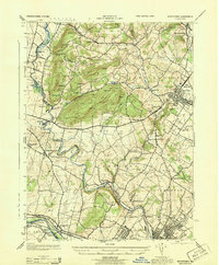
1943 · Boyertown
USGS Topo · 1:31,680
Featured Places
- Birdsboro, PA
- Oley Township, PA
- Village of Jacksonwald, Exeter Township
- Alsace Township, PA
- Browns Mill, Amity Township