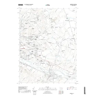
2019 Map of Birdsboro
USGS Topo · Published 2019About this map
Birdsboro and its surrounding Berks County landscape are defined by the winding course of the Schuylkill River, where industrial history and suburban growth converge. The map documents the persistent infrastructure of the Schuylkill Canal and the Schuylkill River Trail, tracing a corridor of transit that has shaped the region's economy for generations. To the north, the Oley Valley presents a distinct cultural landscape marked by numerous family burial grounds and historic farmsteads, such as the Herbein Family Burial Ground and the Kaufman Farm Private Cem.
Find a feature on this map
108 named features on this map. Tap any name to fly to it.
Don’t see what you’re looking for? This feature index may not catch every label — zoom into the map to look around manually.
Map Details
Editions of this 2019 Birdsboro Map
This is the sole edition of this map. No revisions or reprints were ever made.
Other maps of this area

1894 · Reading
USGS Topo · 1:62,500

1902 · Boyertown
USGS Topo · 1:62,500

1905 · Honey Brook
USGS Topo · 1:62,500

1906 · Phoenixville
USGS Topo · 1:62,500

1907 · Honeybrook
USGS Topo · 1:62,500

1913 · Reading
USGS Topo · 1:62,500

1915 · Reading
USGS Topo · 1:62,500

1941 · Honeybrook
USGS Topo · 1:62,500

1943 · Manatawny
USGS Topo · 1:31,680
1943 · Boyertown
USGS Topo · 1:31,680
Featured Places
- Birdsboro, PA
- Oley Township, PA
- Village of Jacksonwald, Exeter Township
- Alsace Township, PA
- Browns Mill, Amity Township