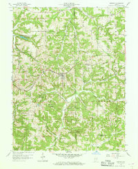
1957 Map of Birdseye
USGS Topo · Published 1968About this map
Birdseye serves as a central hub in this Southern Indiana landscape, where the Southern Railway cuts through the ridges and valleys of the mid-20th century. The area is defined by a dense network of family-named cemeteries and rural congregational centers, such as St Joe Ch and Anderson Valley Ch, reflecting the deep-rooted genealogical history of Dubois, Crawford, and Perry Counties. The terrain is heavily influenced by large-scale timber management, with boundaries for the Patoka National Forest, Hoosier National Forest, and Ferdinand State Forest crisscrossing the map. Waterways like the Anderson River and Lickfork Creek drain the winding hollows, while smaller settlements like Wickliffe and Riceville appear as modest collections of structures along established ridge roads. This survey, based on 1951 aerial photography, captures the region before extensive modern development altered these traditional forest and farm patterns.
Find a feature on this map
47 named features on this map. Tap any name to fly to it.
Don’t see what you’re looking for? This feature index may not catch every label — zoom into the map to look around manually.
Map Details
Editions of this 1957 Birdseye Map
2 editions found
Other maps of this area

1900 · St Meinrad
USGS Topo · 1:62,500

1903 · St. Meinrad
USGS Topo · 1:62,500

1954 · Dubois
USGS Topo · 1:24,000

1955 · Saint Anthony
USGS Topo · 1:24,000

1956 · Greenbrier
USGS Topo · 1:24,000

1956 · Taswell
USGS Topo · 1:24,000

1956 · Vincennes
USGS Topo · 1:250,000

1957 · Vincennes
USGS Topo · 1:250,000

1957 · Cuzco
USGS Topo · 1:24,000

1957 · Birdseye
USGS Topo · 1:24,000