
1957 Map of Birdseye
USGS Topo · Published 1959About this map
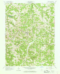
Birdseye serves as the central hub of this late-1950s landscape, where the Southern railroad cuts a path through the wooded drainages of Dubois and Crawford counties. The terrain is defined by a dense network of timberlands including the Ferdinand State Forest, Patoka State Forest, and Hoosier National Forest, interspersed with small rural settlements and family-named cemeteries. To the northwest, the Schnellville Conservation Lake provides a notable water feature near Schnellville, while to the south, the Anderson River and Fox Ridge shape the topography. Local history is anchored by rural institutions like St Joe Ch and Anderson Valley Ch, and numerous family burial grounds such as Waddle Cem, Garland Cem, and Sigler Cem. The presence of Oil Wells near Eckerty suggests a mid-century extraction economy operating alongside the traditional timber and rail industries of Southern Indiana.
Find a feature on this map
38 named features on this map. Tap any name to fly to it.
Don’t see what you’re looking for? This feature index may not catch every label — zoom into the map to look around manually.
Map Details
Editions of this 1957 Birdseye Map
2 editions found
Other maps of this area

1900 · St Meinrad
USGS Topo · 1:62,500

1903 · St. Meinrad
USGS Topo · 1:62,500

1954 · Dubois
USGS Topo · 1:24,000

1955 · Saint Anthony
USGS Topo · 1:24,000

1956 · Greenbrier
USGS Topo · 1:24,000

1956 · Taswell
USGS Topo · 1:24,000

1956 · Vincennes
USGS Topo · 1:250,000

1957 · Vincennes
USGS Topo · 1:250,000

1957 · Cuzco
USGS Topo · 1:24,000
1957 · Bristow
USGS Topo · 1:24,000