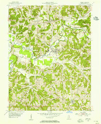
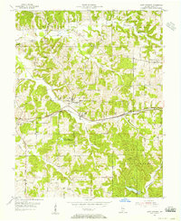
1954 Map of Dubois
USGS Topo · Published 1955About this map
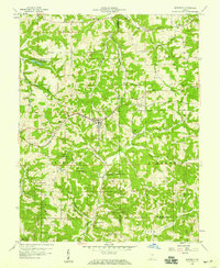
The Patoka River snakes through the center of this mid-century survey, defining the agricultural and rail-oriented life of northeastern Dubois County. The Southern Railway Line follows the river valley, connecting the central hub of Dubois with outlying settlements like Crystal and Polson. The landscape is dotted with centers of community life, notably St Raphaels Ch and St Peters Ch in the main town, and the more remote St Johns Ch to the north near Kellerville. Dense topography is marked by the Harbison Hills and the southern reaches of the Hoosier National Forest, where smaller waterways like Davis Creek and Beaver Creek carve through the terrain. Evidence of early settlement persists in numerous family and church burial grounds, including Harbison Cem and Mt Zion Cem, providing a clear record of local genealogy before the expansion of modern infrastructure.
Find a feature on this map
36 named features on this map. Tap any name to fly to it.
Don’t see what you’re looking for? This feature index may not catch every label — zoom into the map to look around manually.
Map Details
Editions of this 1954 Dubois Map
This is the sole edition of this map. No revisions or reprints were ever made.
Other maps of this area
1946 · Jasper
USGS Topo · 1:24,000
1951 · Hillham
USGS Topo · 1:24,000
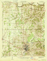
1954 · Huntingburg
USGS Topo · 1:24,000
1955 · Saint Anthony
USGS Topo · 1:24,000
1956 · Alfordsville
USGS Topo · 1:24,000
1956 · Rusk
USGS Topo · 1:24,000

1956 · Vincennes
USGS Topo · 1:250,000

1957 · Vincennes
USGS Topo · 1:250,000
1957 · Cuzco
USGS Topo · 1:24,000
1957 · Birdseye
USGS Topo · 1:24,000