
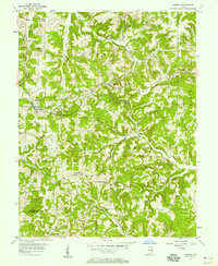
1956 Map of Taswell
USGS Topo · Published 1958About this map
Taswell and Eckerty serve as the primary rail-oriented hubs on this mid-century survey, situated along the corridor of the Southern Railroad. Much of the surrounding landscape is defined by the Hoosier National Forest, which covers a deeply dissected terrain of winding creek valleys including Patoka Creek and Stinking Fork. The distribution of rural landmarks like Fedora Sch, Highfill Chapel, and Potter Cem illustrates a pattern of upland settlement where small community centers developed atop the ridges between the numerous hollows and stream branches.
Find a feature on this map
44 named features on this map. Tap any name to fly to it.
Don’t see what you’re looking for? This feature index may not catch every label — zoom into the map to look around manually.
Map Details
Editions of this 1956 Taswell Map
2 editions found
Other maps of this area

1950 · Beechwood
USGS Topo · 1:24,000

1950 · Valeene
USGS Topo · 1:24,000

1950 · English
USGS Topo · 1:24,000

1950 · Alton
USGS Topo · 1:62,500

1956 · Greenbrier
USGS Topo · 1:24,000

1956 · Vincennes
USGS Topo · 1:250,000

1957 · Vincennes
USGS Topo · 1:250,000

1957 · Cuzco
USGS Topo · 1:24,000

1957 · Birdseye
USGS Topo · 1:24,000
1957 · Bristow
USGS Topo · 1:24,000