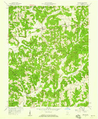
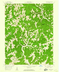
1957 Map of Bristow
USGS Topo · Published 1959About this map
Ferdinand State Forest and the Hoosier National Forest dominate this mid-century landscape in Perry and Dubois Counties. The terrain is deeply etched by the Anderson River and its numerous tributaries, including Sigler Creek and Sulphur Fork Creek. Small rural communities are scattered throughout the wooded hills, from the larger settlement of Bristow in the southwest to isolated crossroads like Siberia, Uniontown, and Sassafras.
Find a feature on this map
39 named features on this map. Tap any name to fly to it.
Don’t see what you’re looking for? This feature index may not catch every label — zoom into the map to look around manually.
Map Details
Editions of this 1957 Bristow Map
4 editions found
Other maps of this area

1900 · St Meinrad
USGS Topo · 1:62,500

1903 · St. Meinrad
USGS Topo · 1:62,500

1954 · Derby
USGS Topo · 1:24,000

1955 · Saint Anthony
USGS Topo · 1:24,000

1956 · Taswell
USGS Topo · 1:24,000

1956 · Vincennes
USGS Topo · 1:250,000

1957 · Vincennes
USGS Topo · 1:250,000

1957 · Birdseye
USGS Topo · 1:24,000

1958 · Vincennes
USGS Topo · 1:250,000
1958 · Branchville
USGS Topo · 1:24,000